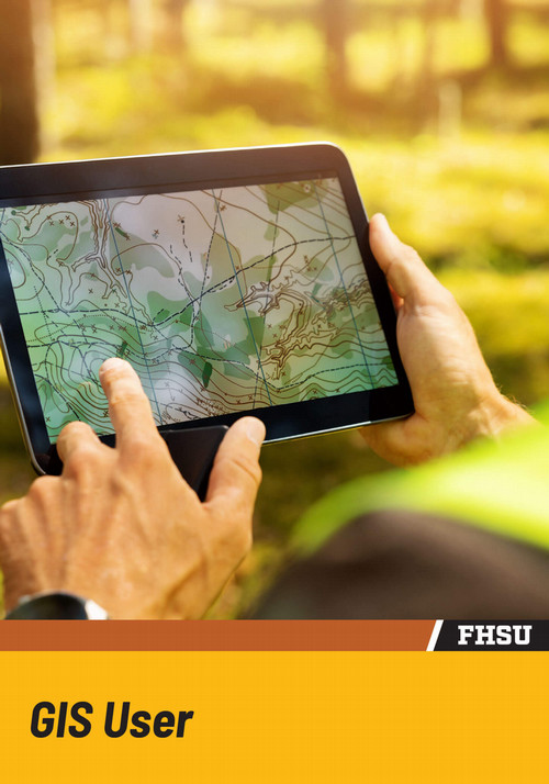
Certificate in GIS User
Hours: 9 On-Campus Online
The Certificate in Geographic Information Systems (GIS) User at Fort Hays State University equips students with essential technical skills for analyzing geographic patterns and spatial relationships. The certificate emphasizes hands-on experience with GIS software, enabling students to interpret complex, location-based data that supports decision-making in areas such as public service, environmental resource management, and local government.
Structured as a nine-credit-hour certificate, the curriculum provides a focused and practical learning experience. Students develop proficiency in GIS tools and analytical techniques that can strengthen performance in their current roles or support advancement into positions where GIS expertise is increasingly valued.
The certificate supports professional development and offers a competitive advantage in careers that rely on geographic information systems, while complementing a student’s broader academic or professional goals.
Who is this program for?
The certificate supports undergraduate students and working professionals by providing hands-on GIS training applicable to fields such as emergency management, public health, natural sciences, and urban planning.
- Current undergraduate students in any major
- Employees in city or county planning offices
- Environmental and natural resource specialists
- First responders or public safety professionals
- Military or intelligence analysts
- IT and data analyst seeking spatial tools
- Social scientists working with demographic data
- Teachers integrating GIS into classroom learning
The Best Value in Higher Education Anywhere
Fort Hays State University prides itself on quality education at an affordable price. Students in this program can expect to pay approximately $1,942.56* (on-campus) or $2,480.85* (online) per semester.
*Estimated cost based on 9 credit hours at the Undergrad resident/regional tuition rate ($215.84/credit hour) for on-campus courses, or the FHSU Online Undergrad tuition rate (275.65/credit hour) for online courses. Actual price may vary depending on course load and location. Tuition and Fees are subject to change as they are approved by the Kansas Board of Regents each year.
The Certificate in GIS User focuses on building essential GIS competencies, beginning with foundational concepts such as map design, coordinate systems, and spatial data formats. Participants also develop skills in areas including raster and vector analysis, geodatabases, GPS methods, and geocoding.
Through applied exercises that reflect real-world GIS tasks, the certificate encourages critical evaluation of spatial patterns and trends, supporting informed decision-making across various fields, including urban planning, environmental monitoring, and public safety.
GSCI 240: Geographic Information Systems (GIS) One
This course introduces the fundamentals of Geographic Information Systems (GIS), combining core theory with hands-on experience using industry-standard software to build practical skills in spatial data analysis.
GSCI 360: Geographic Information Systems (GIS) Two
In this course, students explore spatial analysis techniques using raster, network, and 3D tools, while also covering cartographic design, data creation, and management. Hands-on activities with industry-standard software reinforce technical skills.
GSCI 290: Cartography – Theory and Applications
This course examines the theory and methods of transforming geographic space into maps, including map content, structure, and use. Focuses on map interpretation and extracting information from maps.
Discover the full Certificate in GIS User course listing by visiting the Academic Catalog.
Geographic Information Systems (GIS) professionals are in demand across both public and private sectors. The Certificate in GIS User supports preparation for roles that rely on spatial analysis and mapping by emphasizing industry-standard tools and applied, project-based learning. This focused training enables participants to apply geospatial skills effectively in professional settings.
GIS Technician
GIS technicians manage geodatabases, enter spatial data, and produce maps for engineering firms, municipalities, and transportation agencies. They develop the skills needed to support projects by maintaining data accuracy and performing essential spatial data tasks, providing a foundation for advanced analysis and informed decision-making.
GIS Analyst
GIS analysts conduct advanced spatial modeling and analysis for local governments, conservation agencies, and businesses. They evaluate geographic trends, apply spatial statistics, and deliver map-based insights that inform public planning and organizational decision-making.
Remote Sensing Specialist
Remote sensing specialists analyze raster data and interpret satellite and aerial imagery to study land use, agriculture, environmental changes, and disaster zones. They are prepared for roles in government agencies, research organizations, and other sectors that rely on geospatial intelligence.
GIS Business Analyst
GIS business analysts use geographic data to support business intelligence in the private sector. They develop skills to analyze spatial information for tasks such as identifying optimal locations, defining customer zones, and optimizing supply chain operations.
Emergency Response Specialist
Emergency response specialists utilize GIS to map hazard zones, evacuation routes, and emergency service coverage areas. They are prepared for roles that support community safety, collaborating with law enforcement, fire departments, and public health agencies.
Ready for the next step?
Our faculty would be excited to talk to you about how our department programs can help you explore your interests and prepare you for a variety of rewarding careers.
Related Programs
Students pursuing the Certificate in GIS User often have interests that overlap with other technical or spatial disciplines. Fort Hays State University offers programs that complement and expand GIS knowledge, which can be taken alongside the certificate to enhance career prospects and deepen interdisciplinary expertise.
The Certificate in GIS User comprises nine credit hours, and students can complete it in as little as one semester for full-time students or over multiple terms for part-time learners.
Students may complete the certificate entirely online or choose on-campus GIS courses.
No previous GIS experience is necessary. Courses begin with foundational instruction and progress into advanced topics, making the program suitable for beginners.
Many students pair this certificate with majors in biology, criminal justice, and others. The credits can complement programs and enhance your academic transcript.
Students who complete the certificate pursue roles such as GIS technician, analyst, business analyst, remote sensing specialist, and emergency response planner across the public and private sectors.
Information about the Department of Geosciences
The Department of Geosciences at FHSU provides students with the opportunity to explore the world through scientific and geographical lenses, preparing them for a wide range of careers that enhance our understanding of the planet. Programs, available both online and on-campus, focus on developing critical thinking and perseverance, equipping students with the skills necessary to succeed in fields such as education, government, industry, and research. With a curriculum that integrates rigorous academic study and practical field experiences, students are empowered to shape their own future success.
Faculty, experts in geology and geography, are committed to offering personalized guidance and support throughout students’ academic journeys. Department of Geosciences graduates are highly sought after across various industries, bolstered by a strong and accomplished alumni network. Whether pursuing studies on-campus or online, students can expect dedicated support to help them achieve their academic and professional goals, ensuring they are well-prepared to make a meaningful impact in their chosen fields.
While earning a degree remains the primary focus, college life offers much more than classroom learning. Students are encouraged to participate in extracurricular activities that foster leadership skills, deepen their understanding of their chosen careers, and provide opportunities to make a positive impact in their communities.
- Sternberg Geosciences Club: The Sternberg Geosciences Club is an active organization for students passionate about geology and related sciences. It provides members with opportunities to participate in field trips, attend guest lectures, and engage in hands-on projects that enrich learning beyond the classroom. Club members collaborate on research, explore geological sites, and contribute to community outreach initiatives, fostering both academic growth and community engagement.
- AAPG/SEG Petroleum Club: The AAPG/SEG Petroleum Club is affiliated with the American Association of Petroleum Geologists and the Society of Exploration Geophysicists. It offers students valuable exposure to the petroleum industry through networking events, industry presentations, and participation in national conferences. The club serves as an excellent platform for students pursuing careers in oil and gas exploration and production.
- WiSTEM (Women in STEM): WiSTEM is an inclusive organization dedicated to supporting and empowering women pursuing careers in science, technology, engineering, and mathematics. The club promotes diversity and provides mentorship opportunities, workshops, and networking events designed to foster professional growth for women in STEM fields.
- Honor Society - Gamma Theta Upsilon: Gamma Theta Upsilon is the international honor society for geography. Membership is by invitation and recognizes students who have demonstrated academic excellence in the field. Members gain access to exclusive events, scholarships, and networking opportunities, and frequently participate in service projects that benefit the community.
- Certificate
- On-Campus
- Online